Richard's Medicine Lake Journey
Day One, August 28, 2004
©Richard J. Gorman 2004
I plan to leave on a Monday, but by midday Saturday, I realize I am going to be ready to leave by the end of
the day. With nothing to hold me back, I leave Sunday morning and make my way to the first planned stop: Lassen
Volcanic.
Clicking the little picture makes the big picture open in a new window.
 |
Driving through Lassen, the spectacular sights start right inside the gates. Between the wildflowers and the minerals
here, the colors are stunning. The Sulphur Works, a large, smelly steam vent near here, is believed to be the central
vent of ancient Mount Tehama. Also nearby is Bumpass Hell, another indicator of the fact that I am on a volcano.
Bumpass Hell is an area of boiling mud pits, in one of which poor Bumpass lost his leg. |
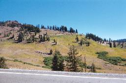 |
Continuing up the main road, the wildflower covered slopes are intense, even at the end of August. For a place
that is snowbound through the winter, Lassen is so alive. There are 715 known plant species in the park, compared
to 485 on Mount Shasta. |
 |
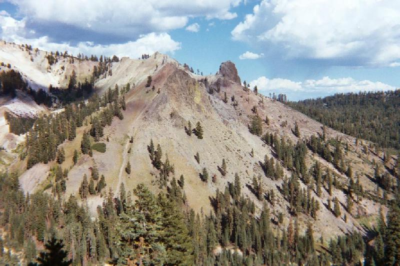
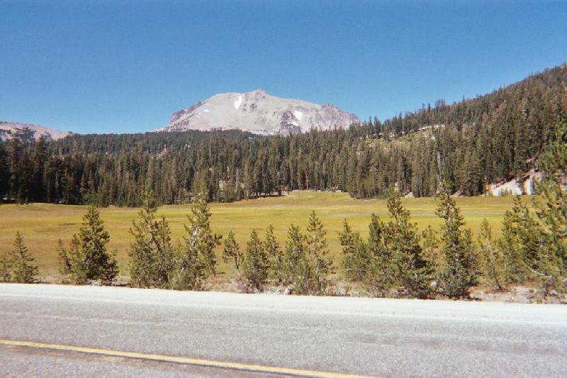
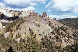
Lassen Peak is really just a remnant of Mount Tehama, an older and larger caldera several miles across. Driving
through Lassen, you are in that caldera. Imagine a vast lake of molten rock, miles across. Over the millennia,
several "rim" volcanoes have formed around the edges of that lake, including Lassen Peak, which arose
as a one cubic mile mass of viscuous lava, probably in the space of about five years. The size and weight of the
dome plugged the vent it rose from, thus it is a "plug dome" volcano. On this side of the peak, you can
see a couple of knobs of hard lava surrounded by talus. |
 |
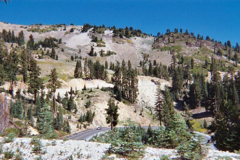
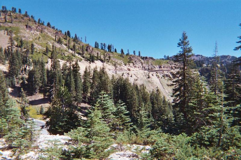
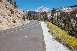
The next two pictures are all about my love for steep windy mountain roads with severe drop-offs on the side. It's
only a seven mile stretch, 35 mph, but there is a lot of good, white-knuckle road in it, tortuous switchbacks and
so on. It is impossible for me to drive and enjoy the scenery, necessitating frequent stops. |
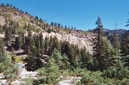 |
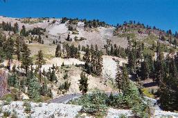
What I really want you to notice in this picture is that line of retaining wall right of center. When I was here
two years ago, there were three places where they were building such structures. At the near end of the wall, you
can see the slide where the road just fell off the mountain. Landslides play an important part in the formation
of the landscape here. |
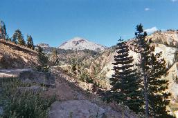 |
Getting closer to the peak now. Tomorrow, I'll take pictures up there. Lassen's last series of eruptions, 1914
- 15, sent a giant cloud of steam and ash several miles into the air. The mushroom cloud was accompanied by an
explosive lateral blast that flattened trees over a wide area on the northeast side, and produced a pyroclastic
flow: an avalanche of superheated rock, melted glacial ice, and debris, that traveled eighteen miles down Hat Creek
and Lost Creek destroying everything in its path. |
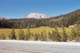 |
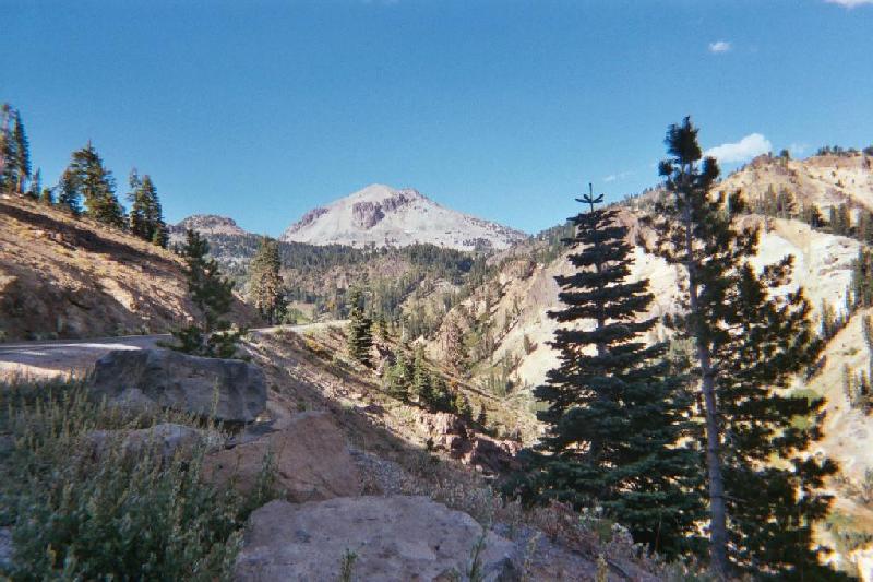
On the north side of the peak, I start to encounter many of the beautiful glacial meadows found here. Two or three
hundred years before the last eruption, Lassen had another significant event, where a steam blast on the northwest
side blew a big chunk off the side of the mountain, creating the feature known as Chaos Jumbles. The Jumbles is
all pink dacite lava, and a pygmy forest grows on it. |
 |
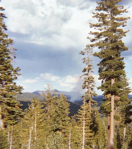
Going north, between the peak and Summit lake, I sight the fire. This is a prescribed burn they have going that
actually had been going on for a few weeks. They have a management crew on it, but are basically letting it do
its thing. It is near where the Pacific Crest Trail passes through the park. |
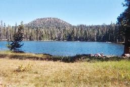 |
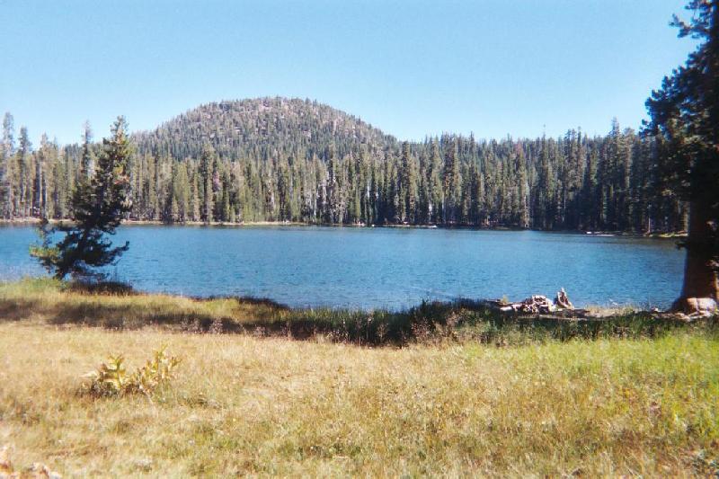
Summit Lake is one of those pretty little glacial meadow lakes, dense forest creeping in at the edges, mule deer
hanging out all around. This is where my first night camp is. It's at 7000 feet, and gives me a chance to acclimate
a little. The hike around the lake is very serene and quiet. |
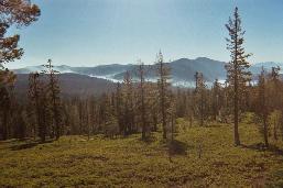 |
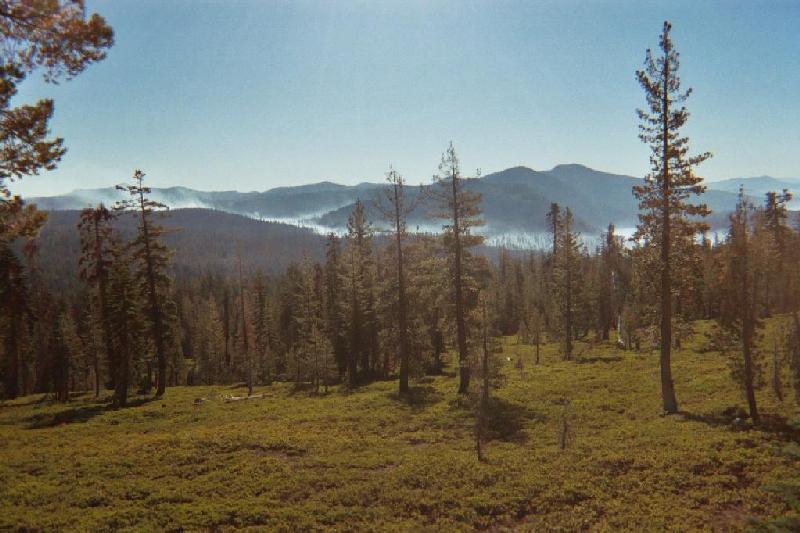
As I drive out of camp in the morning toward the peak, the fire has spread its smoke in the night, laying it down
in the canyons. |
Back to Start Page
On to Day Two