Richard's Medicine Lake Journey

Day Two, August 29, 2004

©Richard J. Gorman 2004

I start Day Two not knowing where I am going to end up. My plan is to break camp in the morning, hike Lassen Peak, and then drive north towards Medicine Lake as far as my remaining energy will take me. One of my planned options is McArthur Burney Falls Memorial State Park, about an hour north of Lassen, and that is where I find myself, with energy to spare.

Lassen Peak

Clicking the little picture makes the big picture open in a new window.

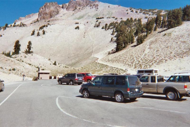
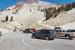
It's smart to visit that little house at the base of the trail before you start. While it looks daunting (the mountain, not the little house), a lot of very ordinary people make it to the top. In two and a half miles you go up over 2000 feet. I found that, for me, it's just a matter of pacing. I get lucky again, in that I have beautiful weather, calm and warm. There is always some wind up there, but it's worse on some days. It is just over a three-hour round trip for me.
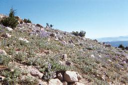
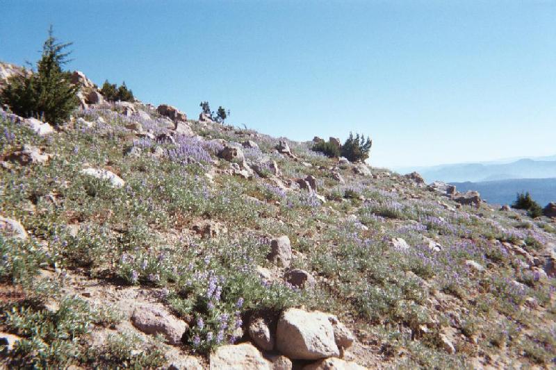
I am struck by the profusion of lupines and other wildflowers on the lower slopes. It is about here in my journey that I realize that I am "wondering" around on this vacation. Wondering if I am up for the hike, wondering where I will stay next, wondering where I will go this week, looking at wonders.
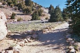
Looks like a nice easy path, eh? Wait 'til you get a little higher. It's like climbing stairs, only they are littered with busted up rock. For whatever reason, I don't take any more pictures on the trail this time. Lassen Peak is mainly talus slopes, weathered fractured volcanic rock. Except in the crater, there is little I would describe as lava "flows", i.e., cohesive chunks of rock. Glaciers play a role in the formation of these landscapes, grinding down all but the hardest lava.
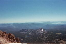
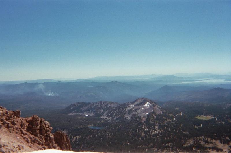
My favorite shot from last time is this view of Reading Peak. The light is different this time, and you can see that fire again on the left, with Lake Almanor on the right. Like Lassen, Reading is a plug dome volcano, with the same talus-covered slopes. There is a little snow on it this year.
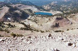
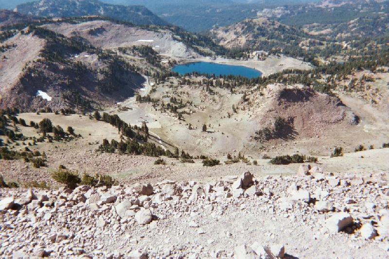
From this vantage point, I am actually able to identify my car down there in the parking lot. Lake Helen is another sweet glacial volcanic crater lake, and I am surprised by the size of the snow patches in her vicinity, this being late August and all. For perspective, the lake is at a little over 8000', the camera is at 10,450'.
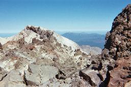
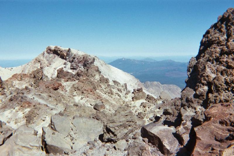
Lassen Peak has a lot of striking lava formations, and I take a lot of pictures. If you like looking at rocks (with some vistas in the background), there are more here. In the 1914 - 15 eruptions, and for a couple of more years, Lassen burped up some lava flows in the crater, but only once actually spilled much out of the crater, a thousand-foot long flow on the west side.
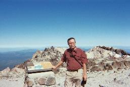
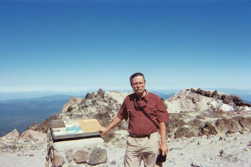
Both times I have hiked Lassen Peak, it has given me a lesson in humility. Last time, it was the Lassen High School girls cross country team who came sprinting up the last stretch of the trail. This time, the few other hikers on the peak wander off out of sight, and I am left alone to enjoy the views. I am hoping someone will come along that I can ask to take my picture, and after a while this older couple shows up, who I had passed on the way up. So I engage them in a conversation, they are nice folks. I mention that I had been there two years before, and the woman says (of her husband), "He was here two years ago, too. In fact he has done this hike every two years since before he turned seventy. He's eighty now." So, I get my picture taken on top of old smoky by an eighty year old. Then I hike down.

Go there!: http://vulcan.wr.usgs.gov/Volcanoes/Lassen/Locale/framework.html


Burney Falls

So, after that hike, I already have my car loaded, and hit the highway north. I am blessed by beautiful mild weather, and it is a Monday, so the traffic is tolerable. I only have to drive a little over an hour to get to Burney Falls, and by mid-afternoon I am settled in the huge deserted campground, and decide to take a look at the falls before dinner. I had heard the name "Burney Falls" several times before in my life, but no one has ever told me how magnetically beautiful the falls really are. I stay there again on the way home on Friday, and I am drawn to the falls repeatedly. I take a lot of pictures, and these are my favorites.

It's not the tallest waterfall I've ever seen. It's not the widest. But it may be the most beautiful. It arises from two different aquifers interacting with two very different layers of lava. In the upper part the one aquifer flows over the porous, younger (1 million years old) layer. Where the two layers of rock meet, the second aquifer springs forth from the top of the much older, denser lava layer like a curtain across the face of the falls.

There is a nice little loop trail that takes you down along the side of the falls, downstream to a little footbridge, up the other side, and across another footbridge upstream. Waterfalls are their own kind of magic. They are negative ion generators. Just being in the presence of one enhances ones sense of well-being.

If this waterfall pumps 100 million gallons of water per day, how many gallons are visible in this photo? The pool at the base is just over twenty feet deep, and the water is a constant 46 to 48 degrees. I'm told there are some pretty awesome trout thriving here. There is a fairly rare colony of Black Swifts inhabiting the the face of the waterfall, and though I go back at what I think will be opportune times, I do not get to see any. Only one of the reasons I want to go back.

The rest of the story on Burney Falls... elevation 3000'... not far from here, downstream a couple of miles, there is a PG&E dam harnessing that 100 million gallons per day, with it's attendant lake. What attracts a large proportion of people to this campground is what I think of as motor sports. I am there on a Monday night, with only a few fisherman widely scattered through the place. I am there again on the Friday of Labor Day weekend on the way back, when the weekenders are moving in. The typical neighbors are the land yachts towing, or the pickup towing, the trailer with (insert motorized land or water vehicle here) with mom and the kids in the SUV behind. The campgrounds get heavy use, as evidenced by all the small litter everywhere. I ask a park employee about it, and am told that this week is the first time all summer that they have had many vacancies. When I leave, there were a lot fewer blue ice bag twist ties from the camp store on the ground, among other things. I'm also told that it is very beautiful in winter, when icicles form on the falls. At $20 a night, it is the most expensive campground I stay in. For me on this trip, coming and going, its major redeeming grace, for which I am sincerely grateful, are the hot showers. The place has really solid infrastructure. And the people who work there are cordial and helpful.

Go there!:

The State Parks Page: http://www.parks.ca.gov/default.asp?page_id=455

The Concessionaire's Page: http://www.burney-falls.com/ Privatization in action.


Back to Start Page

On to Day Three