
Richard's Medicine Lake Journey
Day Four, September 1, 2004
©Richard J. Gorman 2004
On the fourth day, the flexibility of my plans becomes a factor. I had started out thinking I might camp in a different place each night, but I am not done with Medicine Lake. I wake at sunrise again, and decide I should hike that little trail I had seen at the edge of camp, to Little Medicine Lake, before breakfast. It's really more like a large pond, but as I had surmised on the trail from seeing the footprints, it is where the resident deer hang out. It is a nice way to start the day.
Clicking the little picture makes the big picture open in a new window.
|
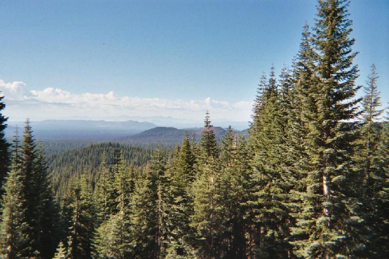
I had asked yesterday about the nearest store, and the rangerette steered me to her family's establishment in the thriving metropolis of Tionesta. Or at least, what once was the thriving, etc. Now, I'm in search of ice and kleenex and lantern mantles (but that's another story). The "store" in Tionesta has the kleenex and a few things I want to add to the cooking kit, but their ice machine is broken, and I drive another fifteen miles to Newell to find that. I take this picture is on the road to Tionesta in the Modoc National forest, looking towards Lassen. There are elk out there somewhere. |
|
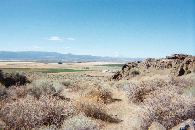
On the highway to Newell, I see the sign for the Petroglyphs Section of Lava Beds National Monument. It is a section that is detached from the rest of the monument, east of it. Being flexible in my plans, and not knowing whether I would get another chance, I decide to go take a look at it. I find a sign that says Petroglyph Bluff, so I park it and follow the trail to the top of the hill. At the end of the trail, an interpretive marker tells me that this site is sacred to an ancient people, and I should go no further. There are pretty views from the top of the hill. |
|
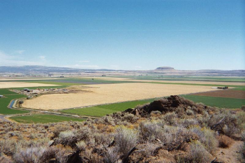
Looking mostly east from the bluff, there is a distinctive looking mountain, with the somewhat obvious name of Doubletop. This whole basin was once a great shallow lake, but there is industrial-scale agriculture going on here now, the rolling sprinklers and the big grain coops served by rail. Grain, potatoes, sugar beets, and horseradish are big money crops in these parts. |
|
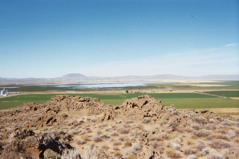
Looking more to the north toward what remains of Tulelake. It is one-sixth the size it was only a hundred years ago, having been drained for cropland. I look all over this place for petroglyphs, seeing none, and thinking I don't know what I'm looking for and that's why I don't see them. The next day I will learn that I have not penetrated all the way to Petroglyph Point, but have stopped about a quarter-mile short on the road. |
|
I spend some time here trying to get a feel for this place the ancients held sacred. According to the Modocs, this is where the creator, Kamookumpts, first made land, using the mud from the lake. The rest of the land was made from this hill. After spending some quiet time here, the thought that strikes me was, "I don't belong here. People that came before me came prepared." Had I known that I am atop the cliff I will see the next day, I would have had other reasons for feeling that I do not belong here! It is a strangely moving place, and a wonder. |
|
Munching lunch on the way back, I decide to go looking for the nearest ice caves. While seeking my first objective, I explore an unmarked cave near the road. These lava tube caves are numerous here, resulting from lava continuing to flow in the interior of a mass while the exterior cools. |
|
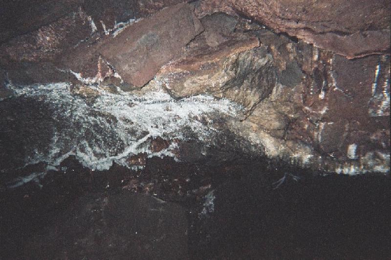
The way most of these caves are found is when a part of the lava tube caves in, exposing the opening. This is the mouth of the Jot Dean Ice Cave, which takes me a while to find, thanks to the little sign being all shot up, like a lot of the signs in this part of the forest. |
|
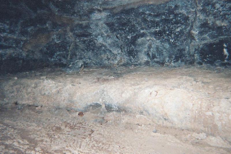
Armed only with my 2 aa-cell pocket light (not a good idea), and a disposable flash camera, I venture in, and I don't have to go very far to find some "cool" ice formations. This is a section of roof ice, all crystally and sparkly, even with the little flashlight. |
|
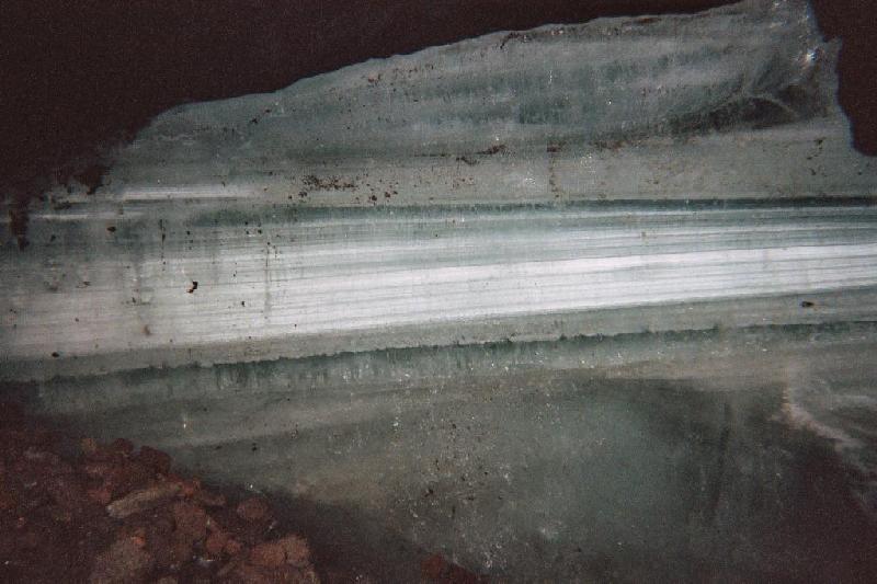
This wall of ice is probably about six inches thick, average, maybe 20 feet wide by 8 feet high. The cheap little camera catches a nice reflection off of the melt pool. This is the 1st of September, it's a nice bright, warm day outside, but you would never know it down here. Being under-equipped and prudent, I don't go any deeper, though the cave clearly went on. But if you die down here, at least you will be well preserved. |
| |
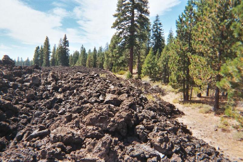
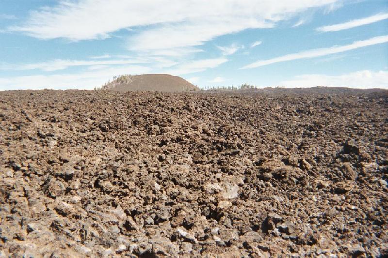
The wonders continue, as I drive out to Burnt Lava Flow in search of the next cave. Like Glass Mountain yesterday, this is a "young" lava flow on the flanks of Medicine Mountain. The same abrupt edge. Only this one is over 8000 acres, and the rock looks literally burnt, blasted. |
| |
If a picture is worth a thousand words, it is pointless to try to describe in a few sentences how breath-taking this moonscape is. It has to be experienced. |
|
|
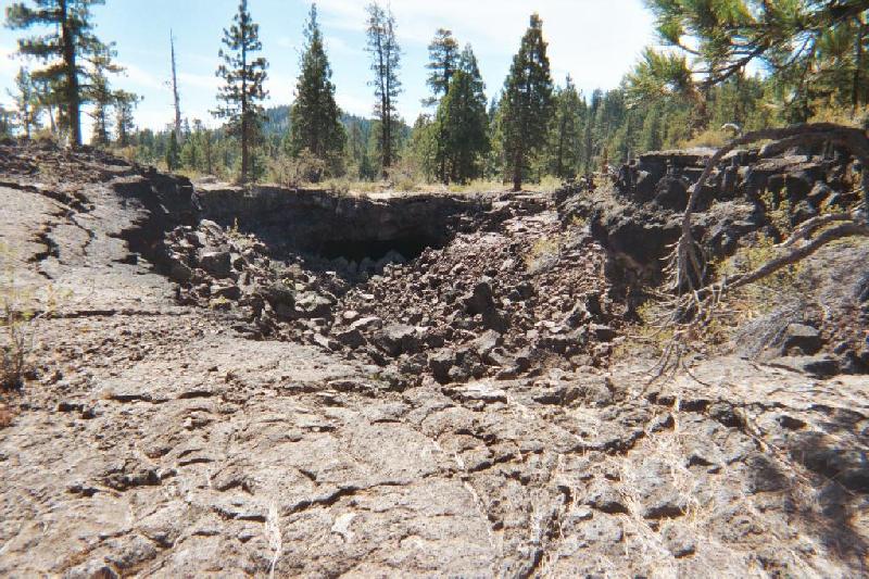
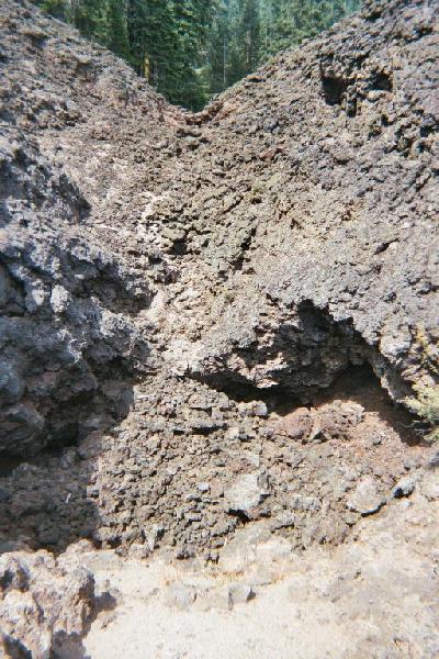
Yellowjacket Ice Cave is on the edge of Burnt Lava Flow, in a sort of crater. Looking down at the mouth, the side I am standing on looks a lot like the side I am looking at. Getting down to the cave mouth is clearly a more formidable task than I am prepared to attempt. But that's just one more reason to go back. |
| |
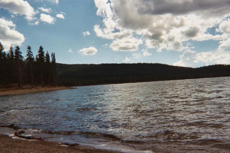
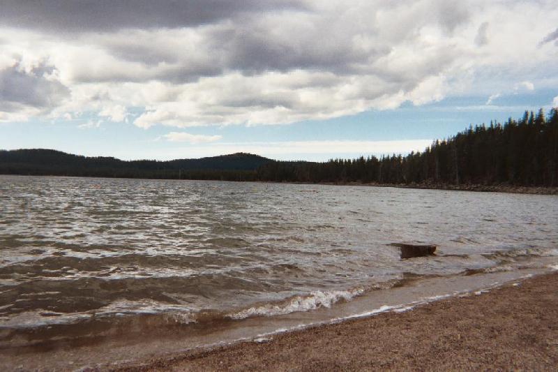
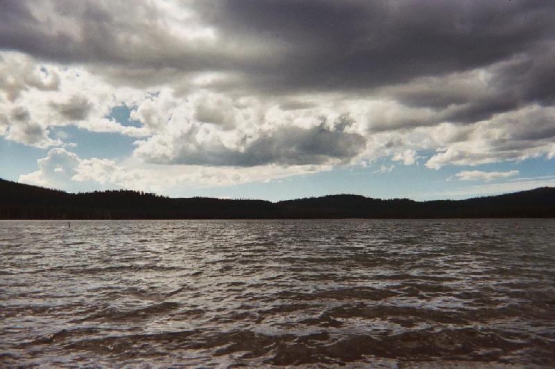
Getting back to camp mid-afternoon, it is warm enough to entertain a dip in the lake. Wasn't that one of the main reasons for coming to Medicine Lake? I take myself down to the nearly deserted swimming beach at the east end of the lake. Looking to the left, there is a couple of people fishing, a popular activity here. Millennia old, Medicine Lake has no known inlet or outlet, yet the water is crystal clear. |
| |
Looking to the right, the campground will be near the center of the picture. There are a lot of breaks in those clouds, sun shining through, as they move east. I call this phenomenon "The Amazing Flying Sky". I had not come seeking "medicine" for any particular ill in this place, but it seems important to me to bathe in this lake held sacred by the ancients, and so I do. |
| |
Sitting down to enjoy the view and the day, I am enjoying watching the sky, the sun on my skin, when I notice the eagles. Eight of them, doing a dance only they know, over my left shoulder. Seeing them dance against the clouds, I think it might make a good picture. Reaching for my camera, I watch the convocation dissolve, and relax back into the chair. Only to see them form up again, directly above the lake, a little while later. The eight are now joined by four more, who appear high above the dance, spiral slowly down in, one at a time, until there are twelve dancers. After a time, I can't tell you how long, they dissolve again, peeling off one or two at a time, all heading south along the same line. |
An interesting corollary: Back at camp, there is a newly occupied campsite nearby, and an SUV parked there says "Law Enforcement" on the side. After dinner, my curiosity gets the better of me, and I go to see who owns that car. Now picture this: old, long-haired hippie guy with headband, red puffy eyes, nose running like a fire hydrant, goes in search of a cop. I have the good fortune to meet Ranger Jim, who turns out to be a wealth of information about this place. I would stay an extra day if I could spend it with him. One of the things I had hoped to see there, but don't, is the resident Elk. Ranger Jim tells me that they can be seen in some of the meadows on the other side of the lake. The geology and ecology of the area is also in his purview. I guess I'm not the first person he has met with the problem; he suggests that the lodgepole pine gets a lot of folks.